


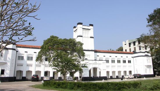

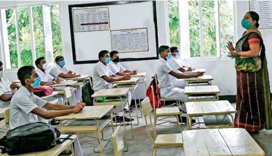
Kelaniya University Undertakes Aerial Mapping of Campus
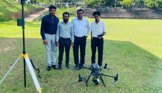
The University of Kelaniya’s Visual Management Committee completed a drone-based survey, marking the first phase of the institution’s campus mapping and visual management project.
The aerial survey covered key locations, including the main Dalugama premises, the Faculty of Medicine in Ragama, and the Faculty of Computing and Technology at Bulugaha Junction. High-resolution imagery and LiDAR technology were used to capture detailed spatial data.
The collected data will be used to develop comprehensive spatial maps, aiding infrastructure planning, landscape management, and future campus development.
The project was supervised by Prof. Nishan Sakalasooriya, Chairman of the Visual Management Committee, with coordination by lecturer Indunil Ranwella. Technological support was provided by Sumathi Information Technologies Pvt Ltd (SIT) and the Department of Geography, University of Kelaniya.
All operations were conducted with prior approval from the Civil Aviation Authority and the Ministry of Defence, ensuring compliance with national aviation regulations.
Related News

When Melodies Light the Dark: The Story of Pahan Tharuwa 2026
Every year, the Faculty of Medicine, University of Peradeniya transforms into a stage of brilliance, harmony, and purpose with Pahan Tharuwa, a…
Read More
Govt to require all preschools to register by July 1 under new regulations
All preschools operating in Sri Lanka must register or renew their registration by July 01 under new regulations, says Women and Child…
Read More
Grade 06 education reforms to begin in January 2027 – PM Harini
Prime Minister and Minister of Education Harini Amarasuriya says Grade 06 education reforms will be implemented in January 2027. Addressing Parliament today…
Read More
Between Pages and People: The Launch of Literary Gazette Issue 02
As the evening of the 26th of April slowly unfolded, there was a quiet anticipation in the air. The backyard of Glayze…
Read More
Celebrating Sri Lankan traditions with the AIESEC Spirit
The spirit of the Sinhala and Tamil New Year comes alive once again as AIESECin the University of Kelaniya proudly presents CN…
Read MoreCourses
-

The future of higher education tech: why industry needs purpose-built solutions
For years, Institutions and education agencies have been forced to rely on a patchwork of horizontal SaaS solutions – general tools that… -

MBA in Project Management & Artificial Intelligence – Oxford College of Business
In an era defined by rapid technological change, organizations increasingly demand leaders who not only understand traditional project management, but can also… -

Scholarships for 2025 Postgraduate Diploma in Education for SLEAS and SLTES Officers
The Ministry of Education, Higher Education and Vocational Education has announced the granting of full scholarships for the one-year weekend Postgraduate Diploma… -

Shape Your Future with a BSc in Business Management (HRM) at Horizon Campus
Human Resource Management is more than a career. It’s about growing people, building organizational culture, and leading with purpose. Every impactful journey… -
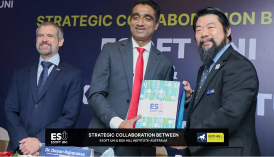
ESOFT UNI Signs MoU with Box Gill Institute, Australia
ESOFt UNI recently hosted a formal Memorandum of Understanding (MoU) signing ceremony with Box Hill Institute, Australia, signaling a significant step in… -

Ace Your University Interview in Sri Lanka: A Guide with Examples
Getting into a Sri Lankan sate or non-state university is not just about the scores. For some universities' programmes, your personality, communication… -

MCW Global Young Leaders Fellowship 2026
MCW Global (Miracle Corners of the World) runs a Young Leaders Fellowship, a year-long leadership program for young people (18–26) around the… -
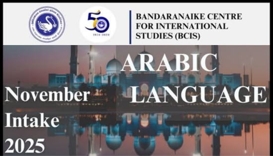
Enhance Your Arabic Skills with the Intermediate Language Course at BCIS
BCIS invites learners to join its Intermediate Arabic Language Course this November and further develop both linguistic skills and cultural understanding. Designed… -

Achieve Your American Dream : NCHS Spring Intake Webinar
NCHS is paving the way for Sri Lankan students to achieve their American Dream. As Sri Lanka’s leading pathway provider to the… -
National Diploma in Teaching course : Notice
A Gazette notice has been released recently, concerning the enrollment of aspiring teachers into National Colleges of Education for the three-year pre-service… -
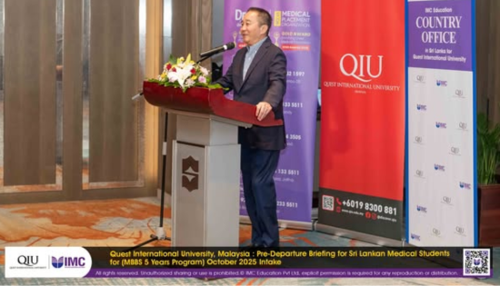
IMC Education Features Largest Student Recruitment for QIU’s October 2025 Intake
Quest International University (QIU), Malaysia recently hosted a pre-departure briefing and high tea at the Shangri-La Hotel in Colombo for its incoming… -

Global University Employability Ranking according to Times Higher Education
Attending college or university offers more than just career preparation, though selecting the right school and program can significantly enhance your job… -

Diploma in Occupational Safety & Health (DOSH) – CIPM
The Chartered Institute of Personnel Management (CIPM) is proud to announce the launch of its Diploma in Occupational Safety & Health (DOSH),… -

Small Grant Scheme for Australia Awards Alumni Sri Lanka
Australia Awards alumni are warmly invited to apply for a grant up to AUD 5,000 to support an innovative project that aim… -
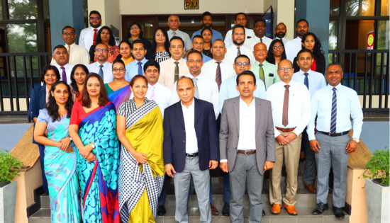
PIM Launches Special Programme for Newly Promoted SriLankan Airlines Managers
The Postgraduate Institute of Management (PIM) has launched a dedicated Newly Promoted Manager Programme designed to strengthen the leadership and management capabilities…
Newswire
-

Dilith says Poland has complained over Sri Lanka passport fraud
ON: May 6, 2026 -
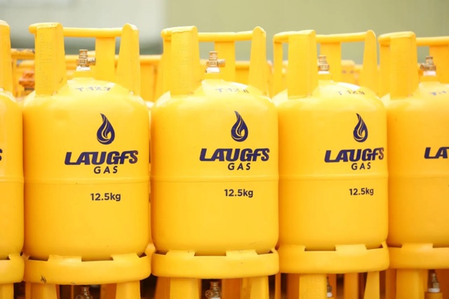
Laugfs gas prices increased from midnight
ON: May 6, 2026